
Thermal Inspections
SERVING CRITICAL SECTORS:
Energy & Utilities
Oil & Gas
Chemical & Petrochemical
Manufacturing & Industrial
Engineering & Environmental
Power Generation & Distribution
Critical Infrastructure
Process Manufacturing
Public Safety & Emergency (SAR)
Thermal Imaging 101
Imagine placing your hand on a sunlit wall and feeling the warmth, even though you cannot see the heat. Thermal imaging works in a similar way. Instead of detecting visible light, it measures the infrared energy, or heat, emitted by surfaces. The accuracy of these readings depends on a property called emissivity, which describes how effectively a material emits thermal radiation.
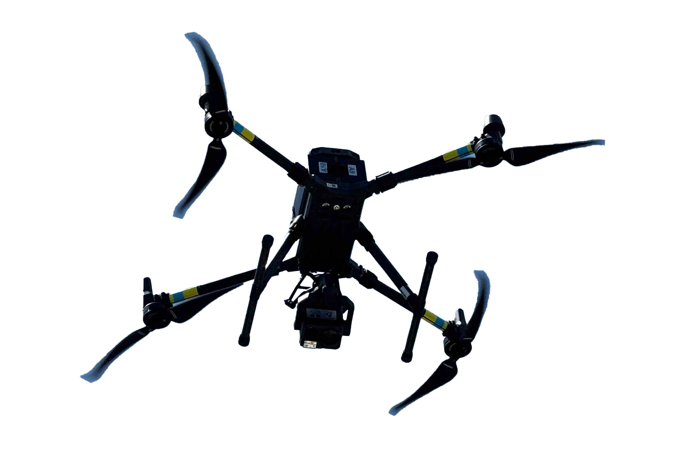
When mounted on a drone, a radiometric thermal camera captures thermal data from above, with each pixel in the image representing an exact temperature value. This allows for detailed analysis of temperature differences across equipment, structures, and natural surfaces.
Thermal imaging via drone is a powerful tool for detecting issues such as overheating components, roof leaks, missing insulation, and water intrusion. It provides a fast, safe, and non-contact method for inspections in fields like industrial maintenance, construction, agriculture, and emergency response.
Explore the interactive samples below to see the power of thermal imaging in action. Unlike standard cameras that rely on visible light, thermal sensors detect heat emitted by objects and surfaces.
This allows us to identify problems that are invisible to the eye, such as hidden moisture, overheating components, or missing insulation. With radiometric thermal data, every pixel records a temperature value, enabling precise analysis long after the flight is complete.

WE HAVE THE TOOLS
TO HELP YOU
SEE THE
INVISIBLE.
The value of an aerial thermal analysis delivers a variety of deliverables and actionable data for end-users. Here are a few key features which set us apart:
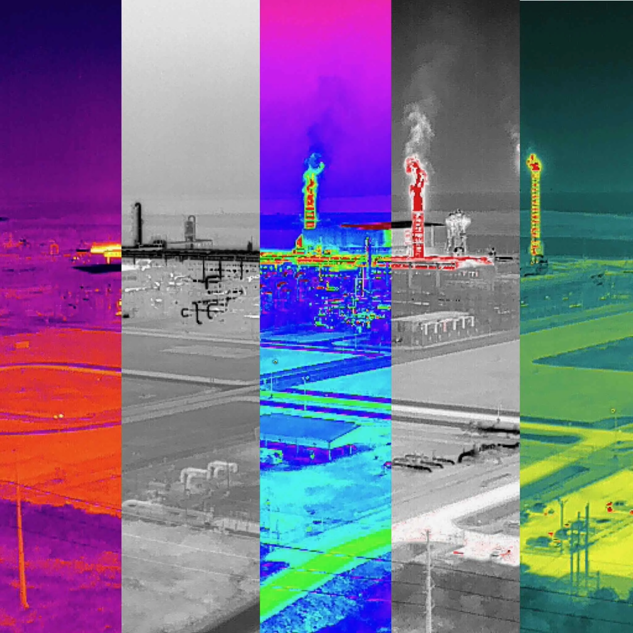
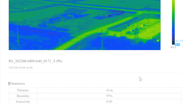
Radiometric Thermal Images: Each pixel contains accurate temperature data for detailed thermal analysis.
Palette Swapping: Adjust color schemes post-flight to highlight key temperature differences.
Side-by-Side Video: Synchronized thermal and visible (RGB) imagery for spatial context.
Temperature Analysis: Pinpoint high/low temps, area-specific min/max, and individual pixel values.
PDF Exports: Clear, shareable reports with annotated thermal captures and temperature data.
Ready to see what can’t be seen? Thermal imaging captures critical temperature data invisible to the naked eye. Whether you're looking for heat loss, electrical issues, or mechanical failures, it reveals problems before they escalate. These insights can save time, prevent costly repairs, and improve operational safety.
Why it matters. Unlike handheld inspections, our drone-based thermal imaging is fast, consistent, and non-invasive. We cover large areas quickly and deliver high-resolution, radiometric data you can trust. It's ideal for rooftops, solar fields, substations, tanks, pipelines, and more.
See it in action. The video below shows exactly how our process works and what sets it apart. If you're responsible for safety, maintenance, or system performance, this is a tool worth watching.
VIDEO: Thermal Inspections
Transforming thermal data into actionable insights for your project.
THERMAL APPLICATIONS
-
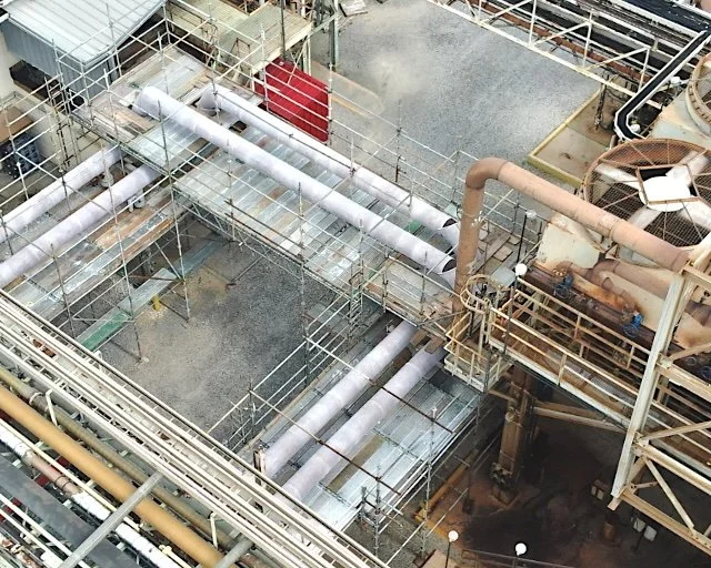
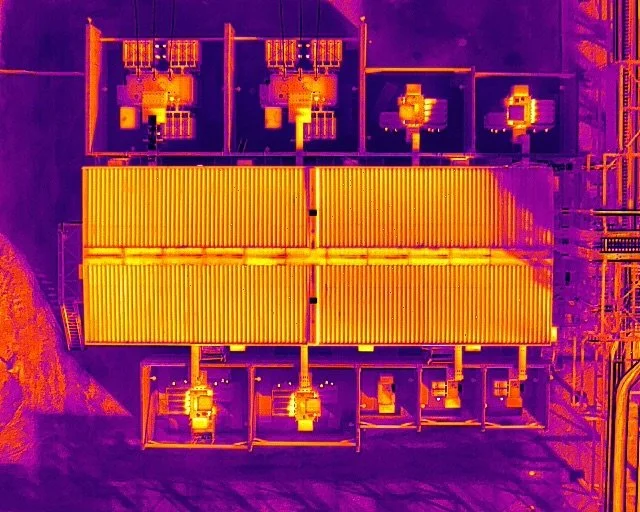
![Industrial Inspections]()
Industrial Inspections
Industrial firms use aerial thermal imaging to inspect assets, monitor conditions and detect anomalies and correct errors before issues arise.
-
![Hot Spot Monitoring]()
Hot Spot Monitoring
Detect overheating components in electrical systems, machinery, or mechanical assets to prevent potential failure or fire hazards.
-
![Leak Detection]()
Leak Detection
Identify thermal irregularities in piping, valves, and insulation to pinpoint air, steam, or fluid leaks that aren’t visible to the naked eye.
-
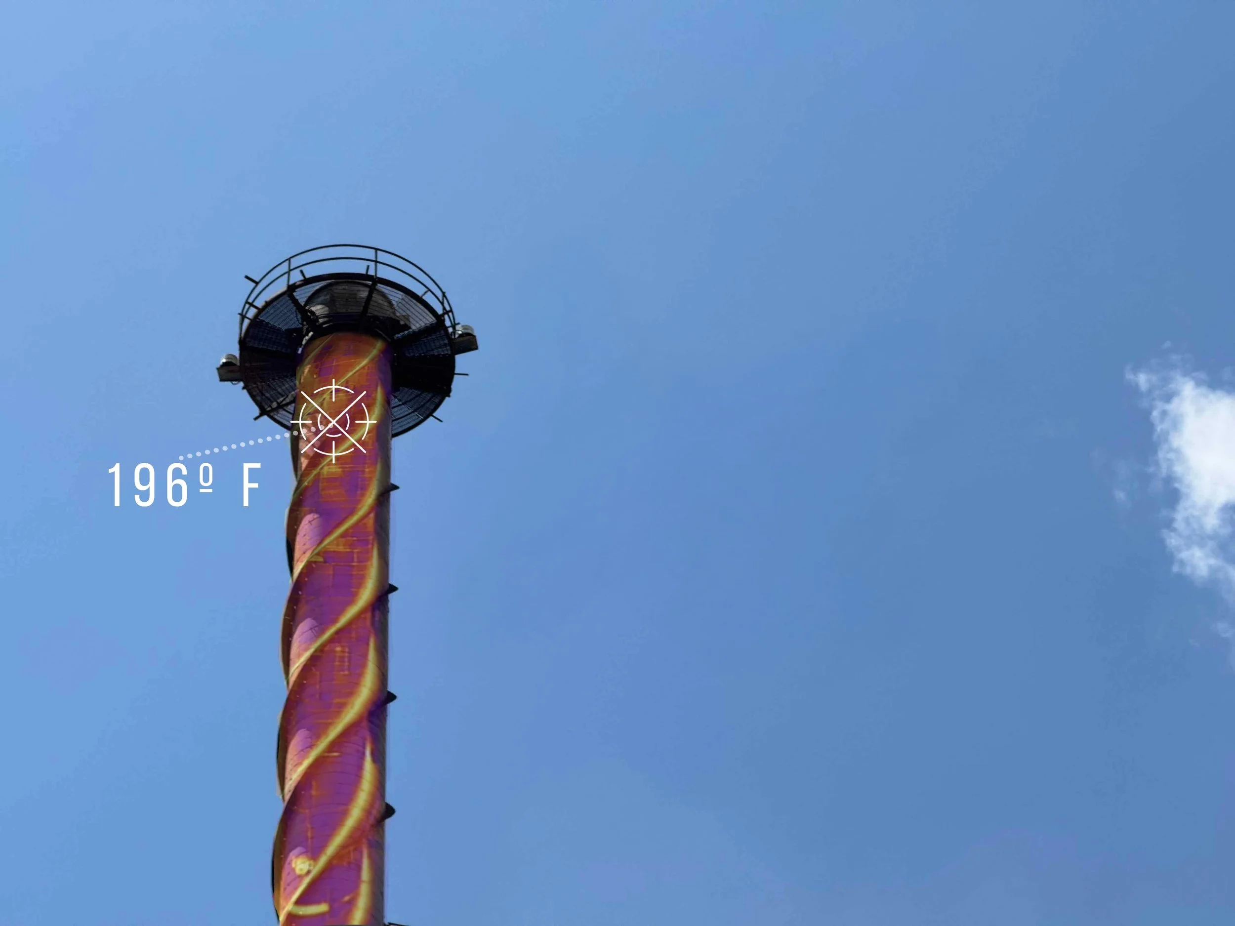
![Flare Stack Inspection]()
Flare Stack Inspection
Safely monitor flare stacks for burn integrity, thermal efficiency, and blockage or irregular combustion — all without interrupting operations.
-
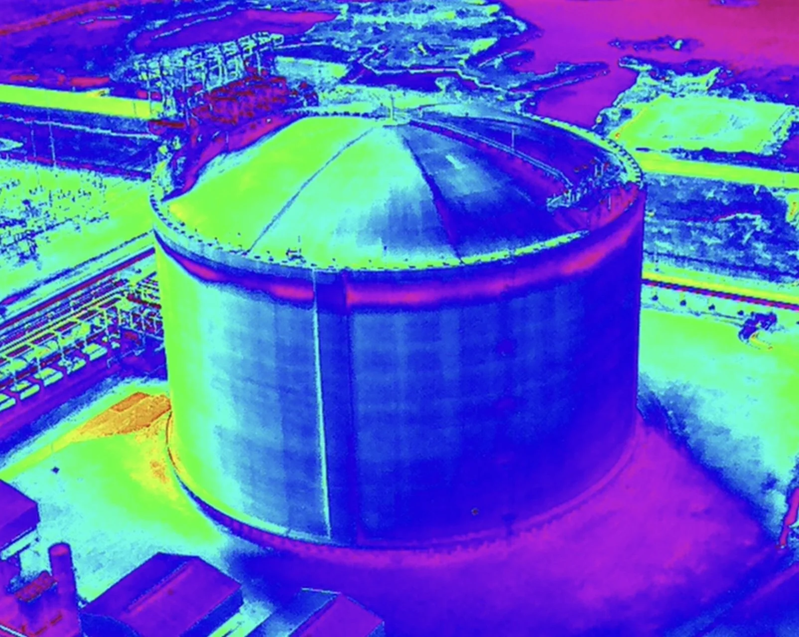
![Tank Thermal Analysis]()
Tank Thermal Analysis
Assess thermal stratification in storage tanks to detect fluid layering, leaks, or uneven heating that may affect process safety or efficiency.
-
![Roof & Building Inspections]()
Roof & Building Inspections
Uncover heat loss, trapped moisture, and compromised insulation in commercial rooftops or building envelopes, improving energy efficiency and maintenance planning.


THERMAL DELIVERABLES:
Explore the examples below to see various thermal deliverables in action.
Thermal PDF Report: A comprehensive PDF report generated after the thermal inspection. It includes annotated imagery, temperature readings, and analysis results, providing clients with actionable insights in a polished, presentation-ready format.

Radiometric Thermal Image: A raw, unedited thermal image captured with full radiometric data. Each pixel contains temperature information and can be imported into industry-standard thermal analysis software for in-depth evaluation (compatible software required).

Thermal Video: An unedited thermal video used for visual reference. While it does not include radiometric temperature data, it effectively illustrates heat patterns and thermal movement across the area of interest.