
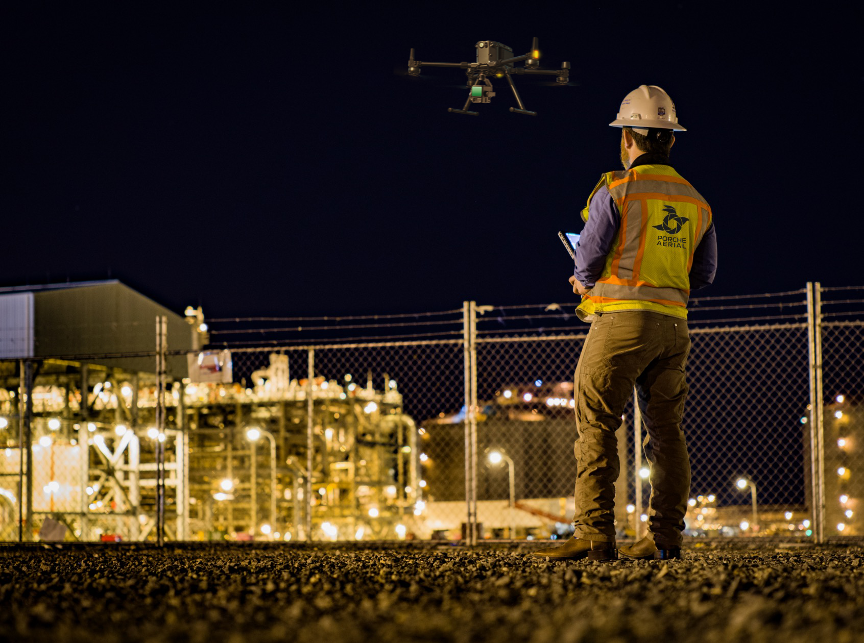
AIRBORNE LiDAR SERVICES
Surveyors & Engineering Firms*
As-Built Mapping & Modeling
Land Development
Enviromental Firms
WE PROVIDE LIDAR SERVICES FOR
Energy & Utilities
Oil & Gas
Critical Infrastructure Inspections
Transmission Distribution / Power Lines
WHAT IS LIDAR?
In today's technological landscape, LiDAR (Light Detection and Ranging) represents a revolutionary advancement in airborne data collection. This combination is transforming various sectors by enhancing the way we gather, map, and analyze data.
Our sensors use light energy, emitted from a laser, to scan the ground and measure variable distances. The end result is a rich set of elevation data that can be used to produce high-resolution maps and 3D models of natural and man-made objects.


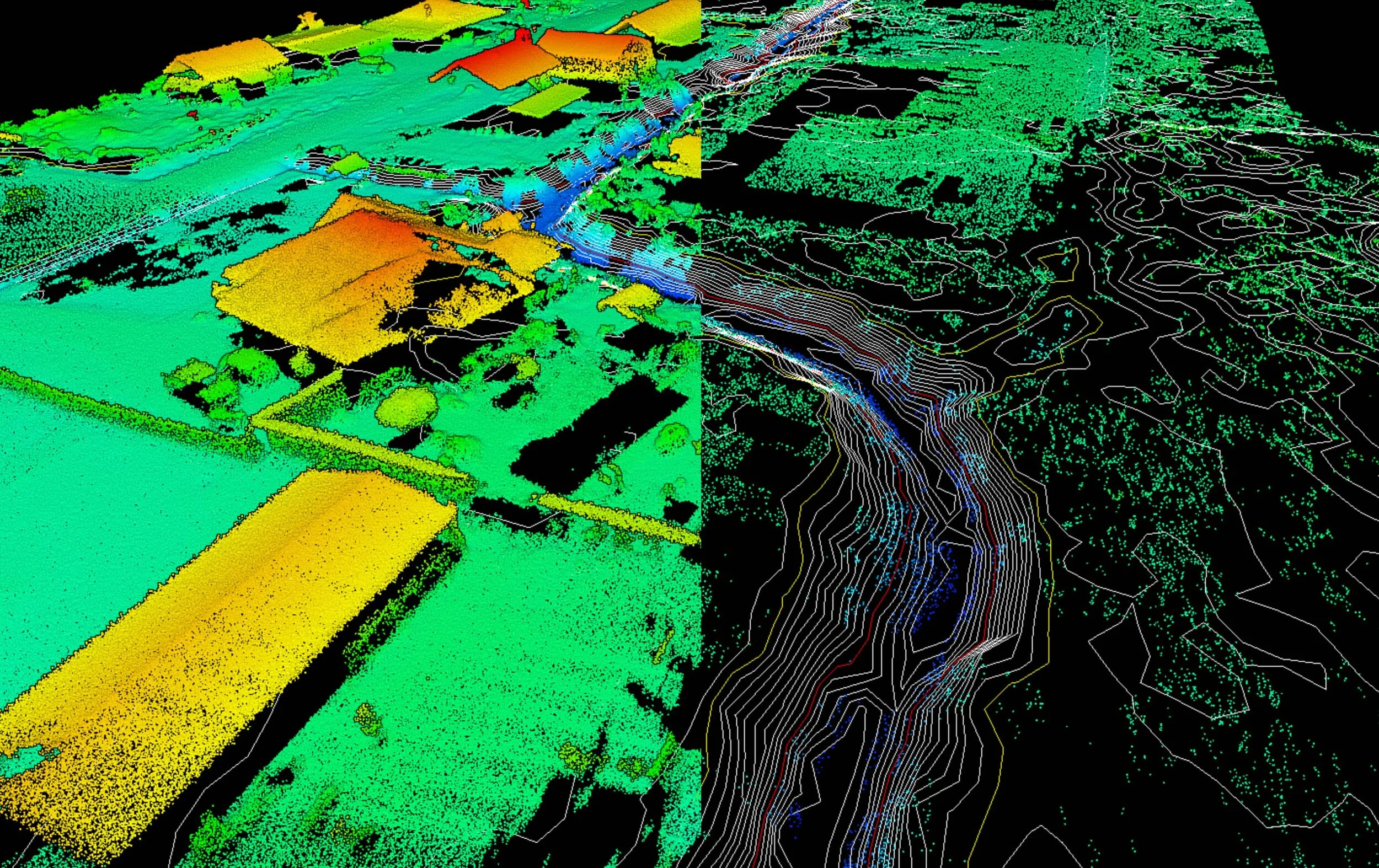
VEGETATION REMOVAL AND TOPO GENERATION
Remove vegetation for bare earth model generation.*

WATER LEVEL TOOLS
Simulate water pooling from LiDAR cross sections.*
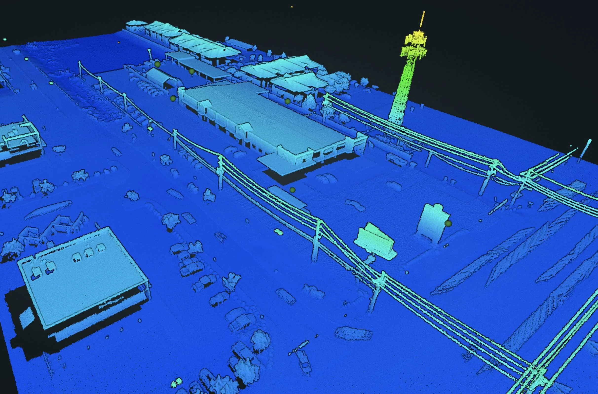
FULL 3D MODEL GENERATION
Accurate and repeatable point clouds.*

ANNOTATION AND MEASUREMENT TOOLS
Collect measurements of your project anytime.*
*Disclaimer: Porche Aerial is not a licensed surveying company. We partner with licensed professionals to deliver survey-grade LiDAR and mapping services.*LiDAR post-processing services available upon request.